Click on the expandable buttons below and learn about the history of the Upper Applegate Valley.
Enjoy reading stories, browse the vast treasure trove of vintage photos and learn about legends that have been passed down through generations.
Before Europeans - 1856: First People - Fur Trappers - Gold Prospectors
| Before
Europeans |
Native Americans who spoke the Dakubetede and Takelma languages – more like autonomous family groups than tribes – used the valley seasonally to hunt and trade. Shastans camped on the Upper Applegate River, just north of the modern Oregon-California stateline. |
| 1820-30s | Fur trappers for the Hudson Bay Company, based at Fort Vancouver, explored and traded their way south into California, passing through what we call Bear Creek Valley east of the Upper Applegate and Illinois Valley and the Pacific Coast to the west. Few if any ventured through the Upper Applegate. |
| 1850s | Gold was discovered near Table Rock City (later named Jacksonville) and the rush was on. Some miners like William “Billy” Dorn and J. J. Elliott pushed far beyond the boomtown to prospect the headwaters of the Applegate River. |
| 1852-56 | The Rogue River Indian Wars mainly occurred elsewhere, but there were a few significant episodes in the Upper Applegate Valley. James Bishop who settled on Bishop Creek was killed in a skirmish in 1855. Mule Mountain got its name when, in January of 1856, soldiers from Fort Lane were seeking a band of Indian warriors. “A mule belonging to the howitzer train, and loaded with ammunition for the piece, lost its footing and fell down a steep bank into the river, and thus the ammunition was lost.” Table Rock Sentinel, Jan. 5, 1856. |
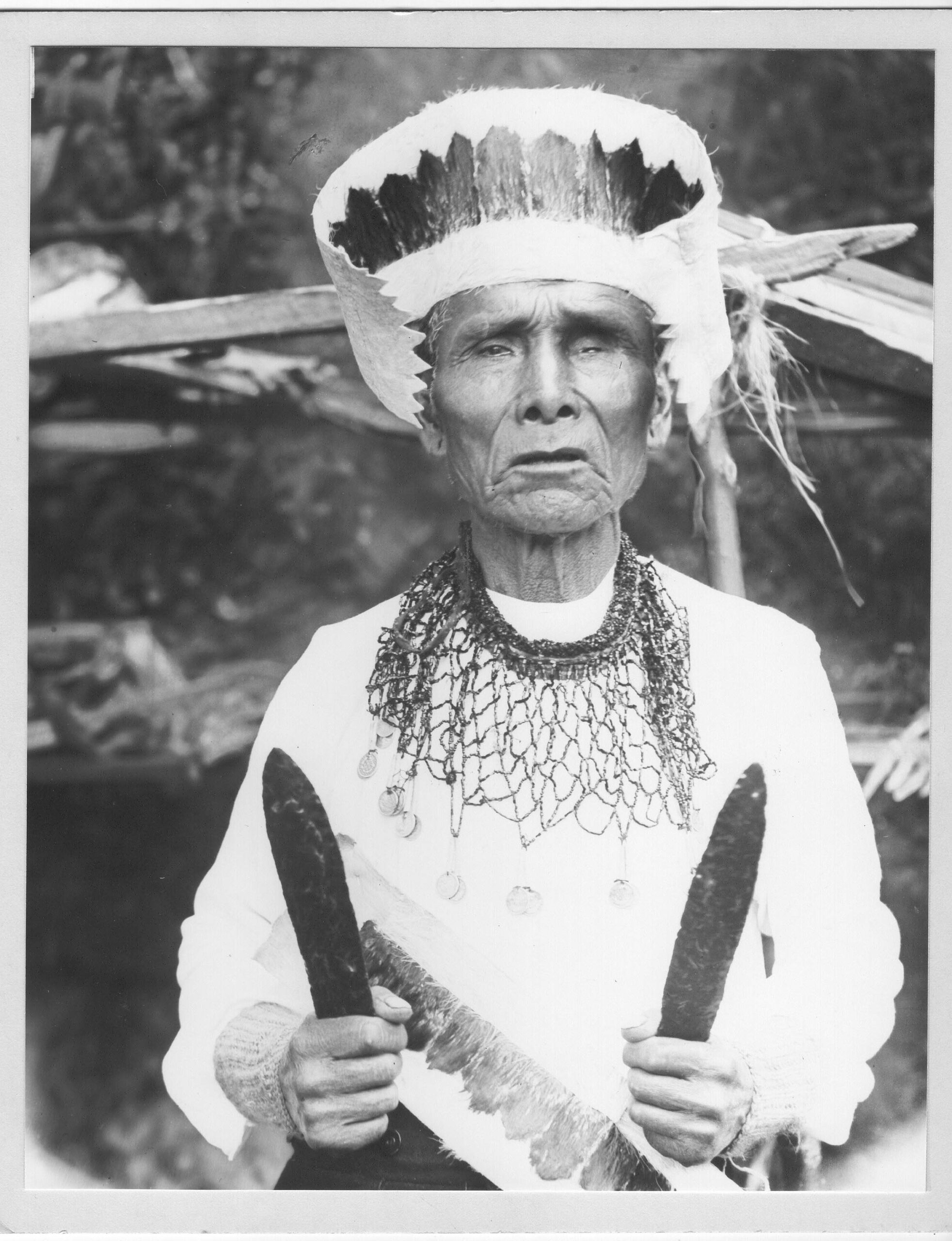
A Rogue River Indian.
Evelyn Byrne Williams collection.
1853 - 1860: The McKees and Their Neighbors
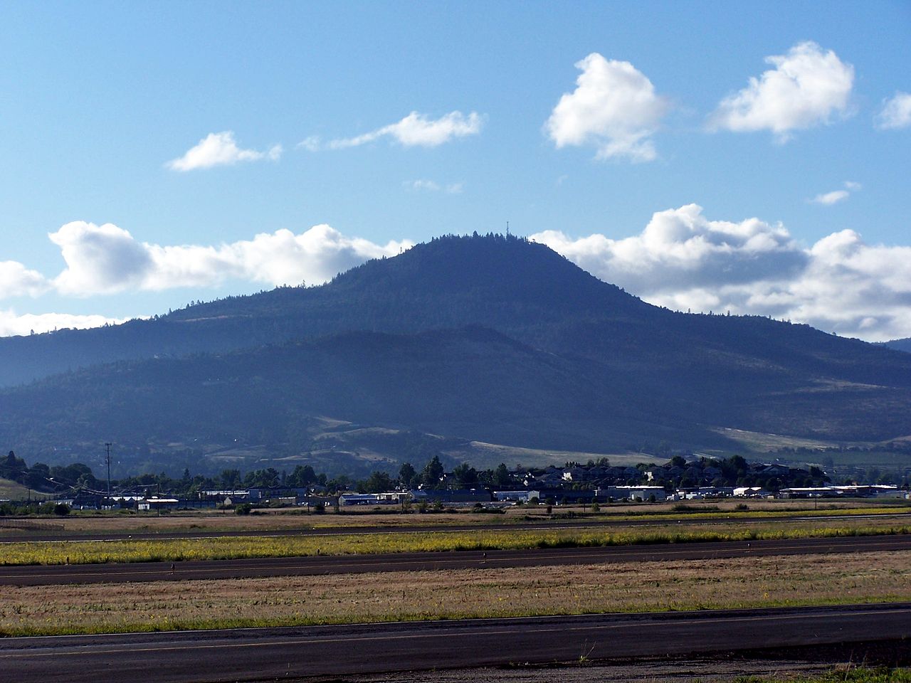
Roxy Ann Butte.
Photo: Laura Ahearn.
| 1853 | The McKee-Bowen wagon train party from Missouri arrived in the Rogue River Valley, Oregon Territory, and made a Donation Land Act claim for 640 acres on the slope of a butte they named after the grandmother – Roxy Ann Hutchinson Bowen. |
| 1855 | The McKees moved to Logtown, also known as Forestville. |
| 1861 | The McKee’s neighbors, Mary Hinkle and her 2 daughters, died in a house fire. Murder to cover up robbery of gold was suspected. The victims were probably among the very earliest burials on the McKee’s property (today’s Logtown Cemetery), although not formally documented. |
| 1860s | White miners lived among the Native Hawaiians at Kanaka Flat and took Native American wives. A small pox epidemic in 1868-69 left many dead, such as Ed Langley’s wife Nancy “Chick-Chick” Weakever. Daughter Martha & son Charles survived but the fates of 2 other children are unknown. Miner Fred Lewis also possibly died in this outbreak, leaving his Shasta wife Bessie widowed and their daughter Sophia deaf. |
1870 - 1877: Settling Big Applegate
| 1870s | Miners like Langley, Freeman Collings, Mark Watkins & Sylvester Arrasmith and their Indian wives – Bessie Lewis, Sophia Lewis, Martha Langley & Celia respectively – turned to farming in “Big Applegate” – the area now inundated when Applegate Dam is closed. A matriarchy of Native American women coalesced. |
| 1877 | The county wagon road from Logtown/Forest Creek reached Big Applegate. Traffic had to ford through the water at Little Applegate, John Wright’s ranch, and Nicholas Wright’s place which had a small store and post office. |
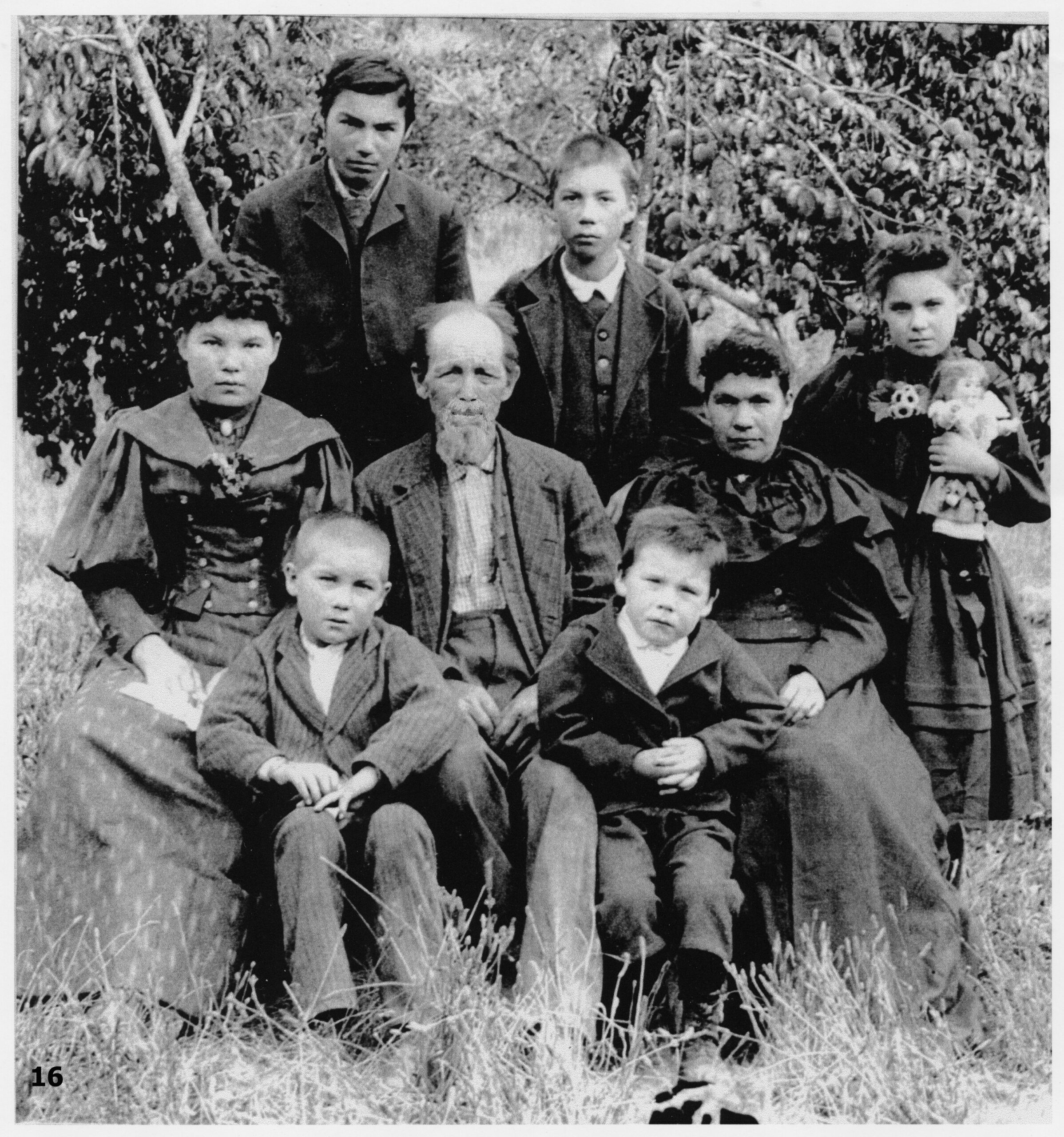
The Collings family 1893.
Vernon Arnold collection.
Late 1870s - 1910: Mining
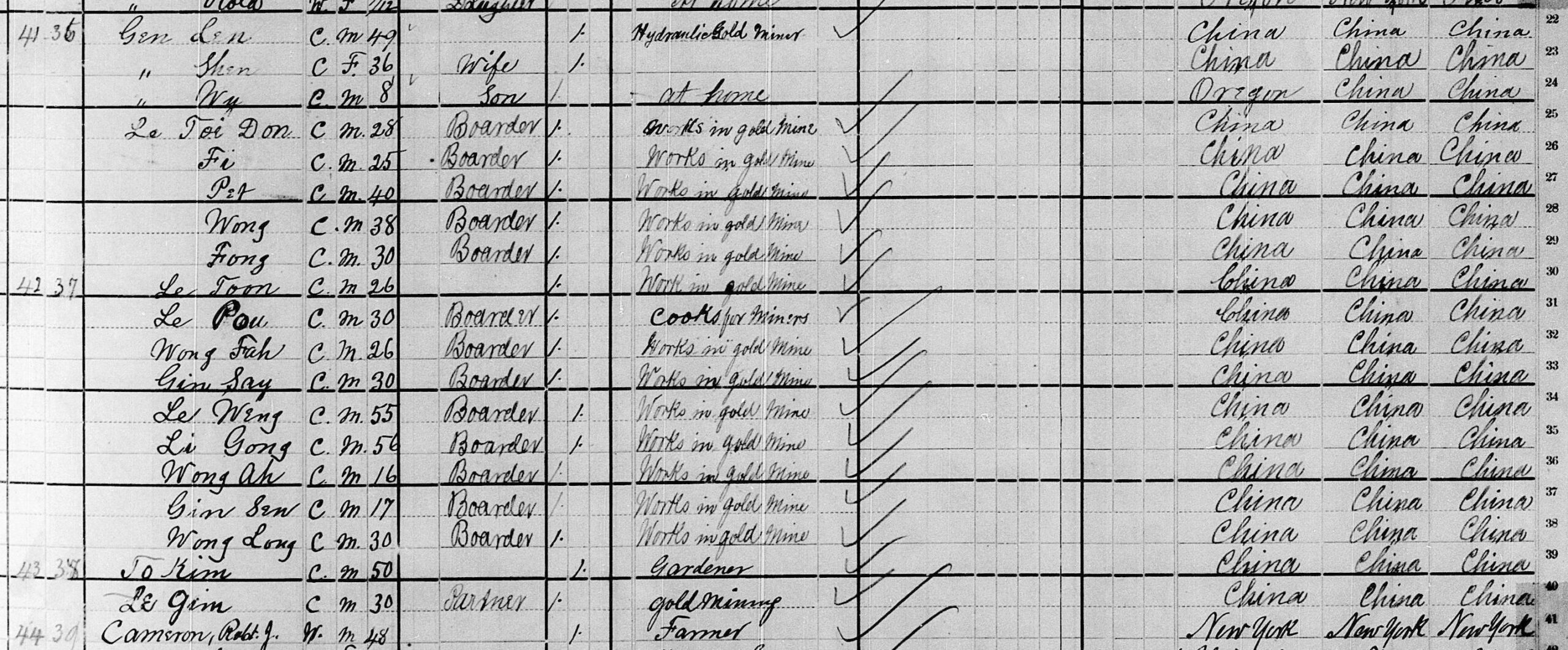
1880 census for Union Town recording “Gen Len” and crew next to Robert Cameron’s farm.
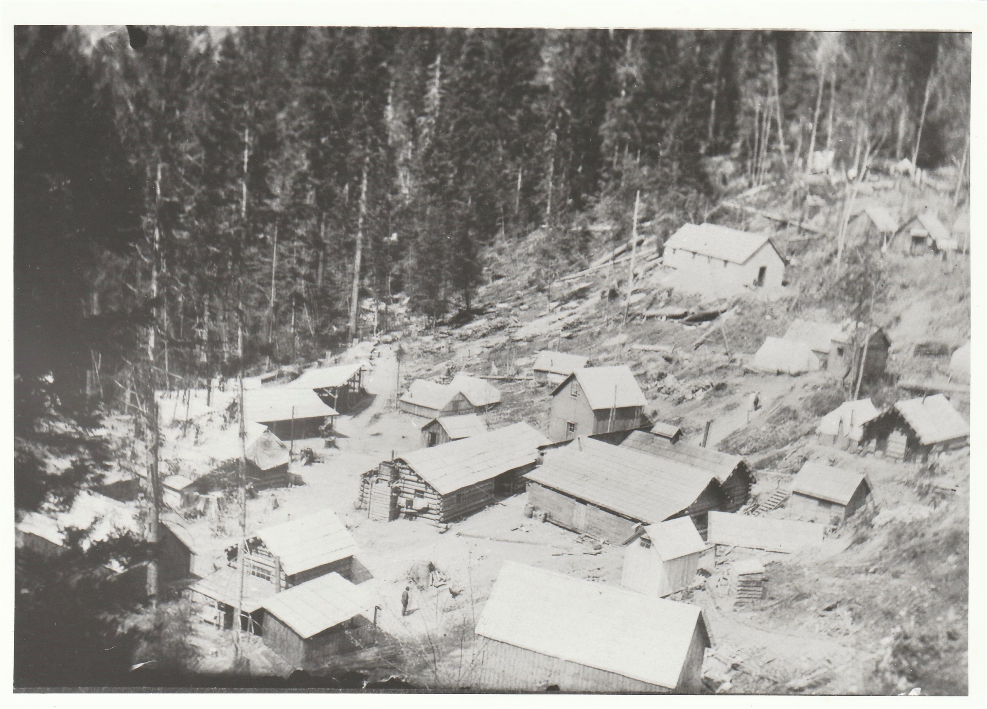
The Blue Ledge Mine camp.
Evelyn Byrne Williams collection.
| Late 1870s- 1880s | Gin Lin oversaw dozens of Chinese miners to dig miles of ditches and conduct large-scale hydraulic mining along the Applegate, including on Robert Cameron’s property at the confluence of Little Applegate River, and the hillside now home to the Gin Lin National Recreation Trail and Flumet Flat campground. |
| 1898 | A large and rich vein of copper – the Blue Ledge – was discovered around 4 miles south of the Oregon-California line. |
| 1905 | New York mining magnate Robert Towne acquired Blue Ledge Mining Company and began development of its unpatented claims. Lacking a wagon road much less a railroad to the remote mine, there was no way to ship out the ore. Around this time Jackson County chiseled Eastside Road into the cliffs along the Applegate River to eliminate the fords. |
| 1907 | A wagon road to the Blue Ledge camp was completed and the town of Eileen began its extremely brief existence. Stage coaches made biweekly runs from Jacksonville to deliver supplies and personnel, stopping at Deb McKee’s place for a meal and change of horses. Newspaper reports claimed “the mine is working 200 men” but actual records from the mine reveal a much smaller workforce. |
| 1910 | Because of stagnant copper prices, with no progress having been made to build the long-promised railroad, the Blue Ledge Mine was mothballed. |
1911 - 1916: A National Forest - WWI
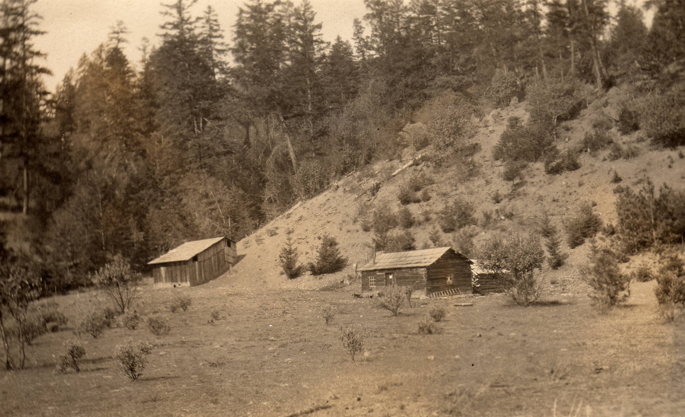
This station on the Star mining claim was used by Ranger Horace G. Whitney until the “tack room” was built at Star Gulch in 1911. Historical Records Collection of the Rogue River National Forest, courtesy of SOU Hannon Library.
| 1911 | Star Ranger Station was established. |
| 1916 | Copper demand skyrocketed with the onset of WWI in 1914. Other mines in the region quickly geared up but it took Blue Ledge Mine almost 2 years. In late 1916 the Blue Ledge Mine made its first-ever shipment of ore using 4-horse teams pulling wagons. |
1917 - 1921: Covered bridges - Demise of Blue Ledge
| 1917 | Two covered bridges were built by Jackson County to provide a detour around Dead Horse Hill. The bridge built on land donated by Deb & Leila McKee became known as … McKee Bridge. |
| 1921 | Blue Ledge Mine halted operations. |
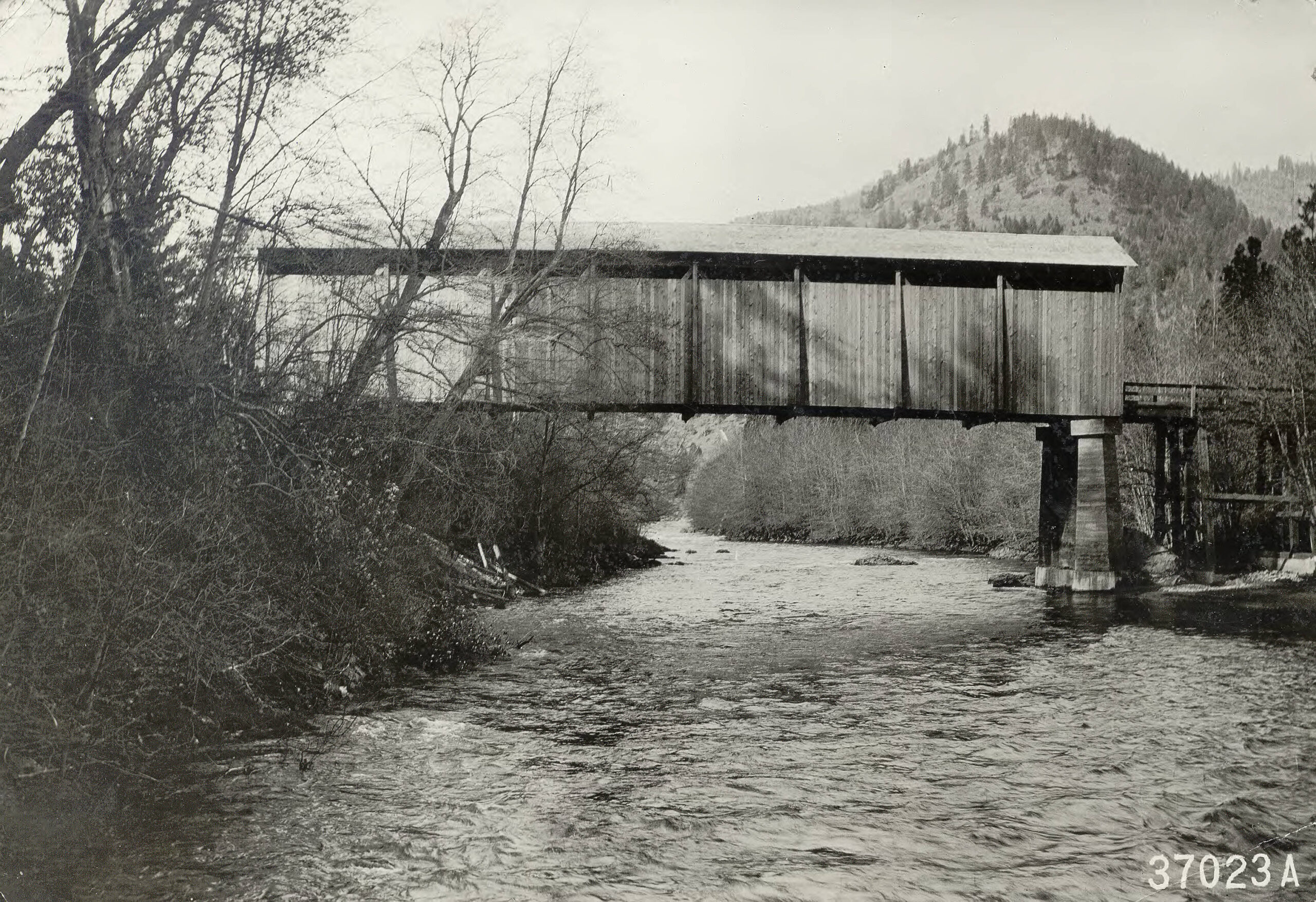
McKee Bridge, viewed from the east shortly after construction was completed in 1917. Historical Records Collection of the Rogue River National Forest, courtesy of SOU Hannon Library.
1933 - 1935: Civilian Conservation Corps.
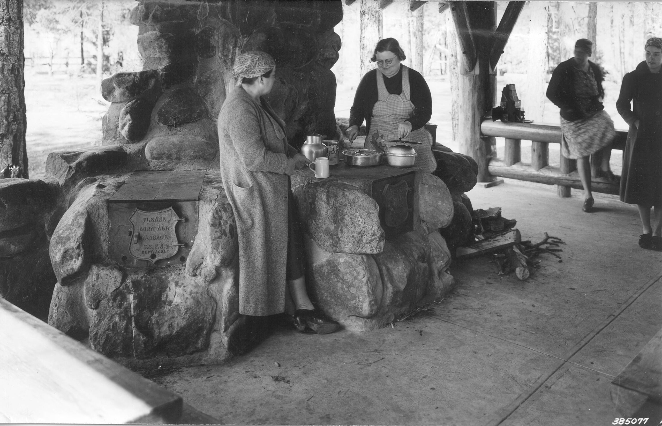
Community kitchen at McKee Bridge “Forest Camp.”
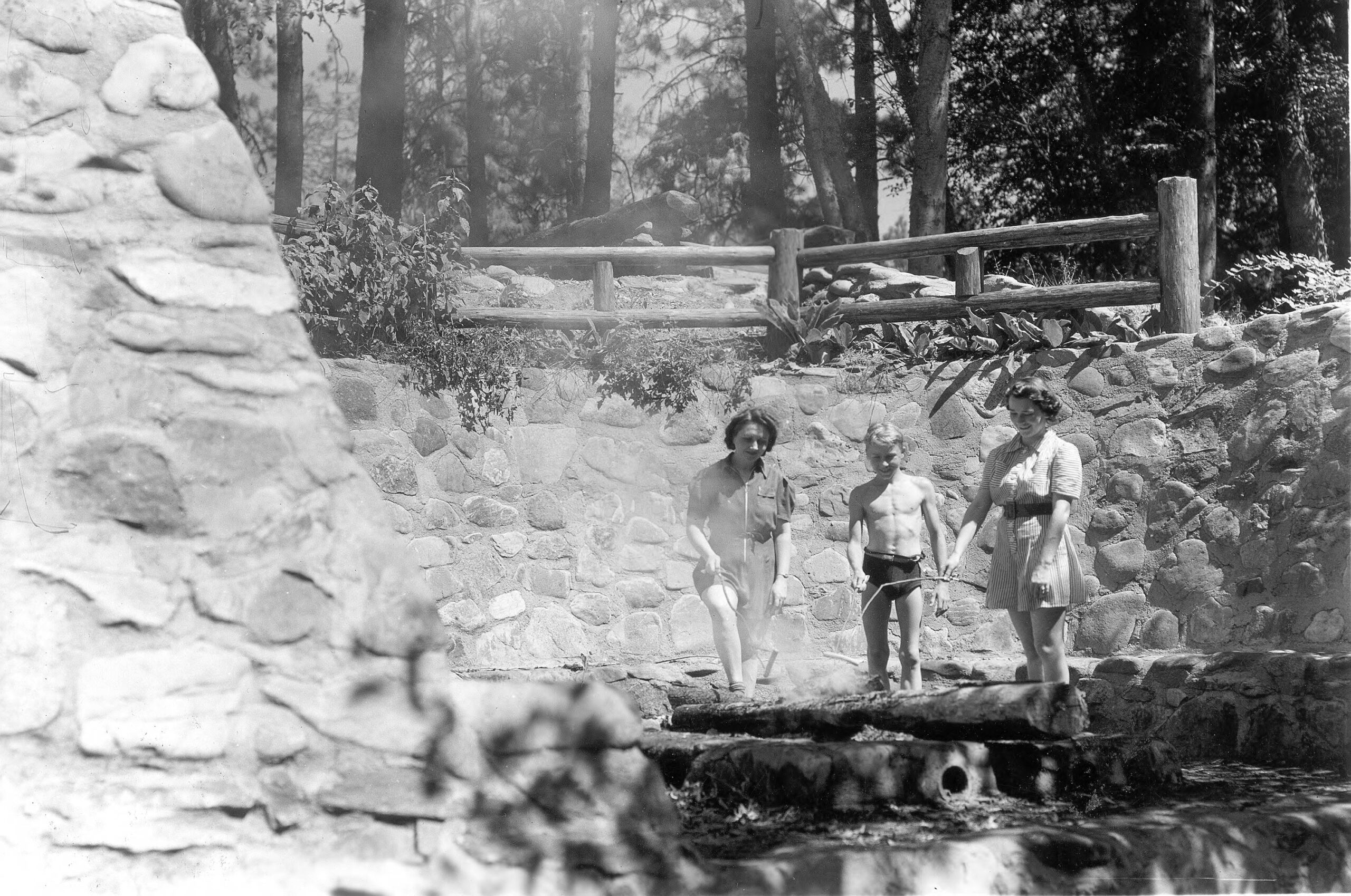
Stone terrace built by the CCC at the “Forest Camp.” Historical Records Collection of the Rogue River National Forest, courtesy of SOU Hannon Library.
| 1933-35 | During the Great Depression the Civilian Conservation Corp built the rustic stone kitchen shelter and camp stoves, as well as a stone terrace along the swimming hole, which you can still enjoy today at the McKee Bridge Picnic Grounds. |
1936 - 1956: The Grange
| 1936 | Upper Applegate Grange members built a large community hall just north of McKee Bridge. The hall was destroyed by fire in 1955. |
| 1956 | Jackson County declared McKee Bridge unsafe for vehicular traffic. |
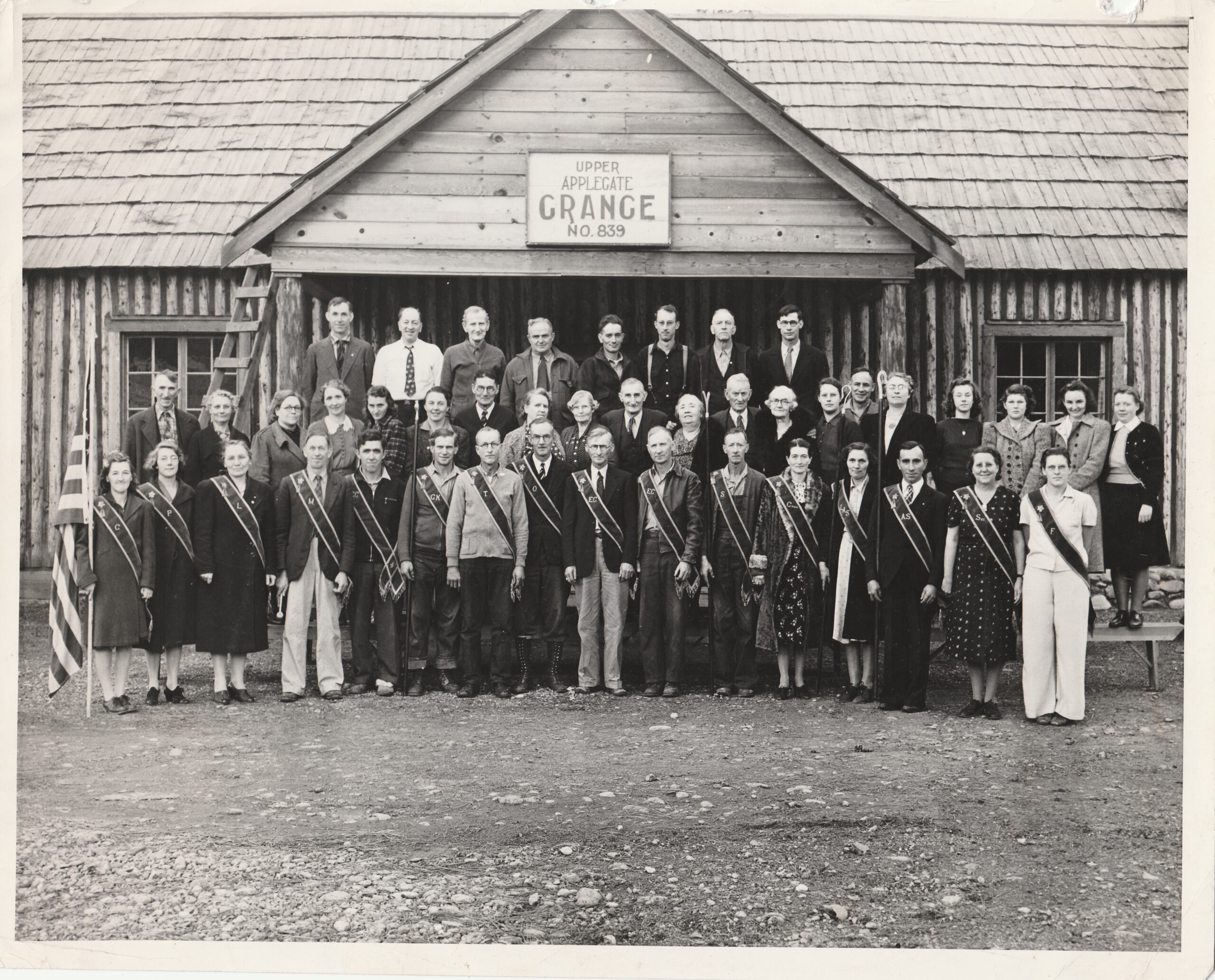
Upper Applegate Grange Hall November 1940.
Evelyn Byrne Williams collection.
1956 - 1999: Community - The Dam
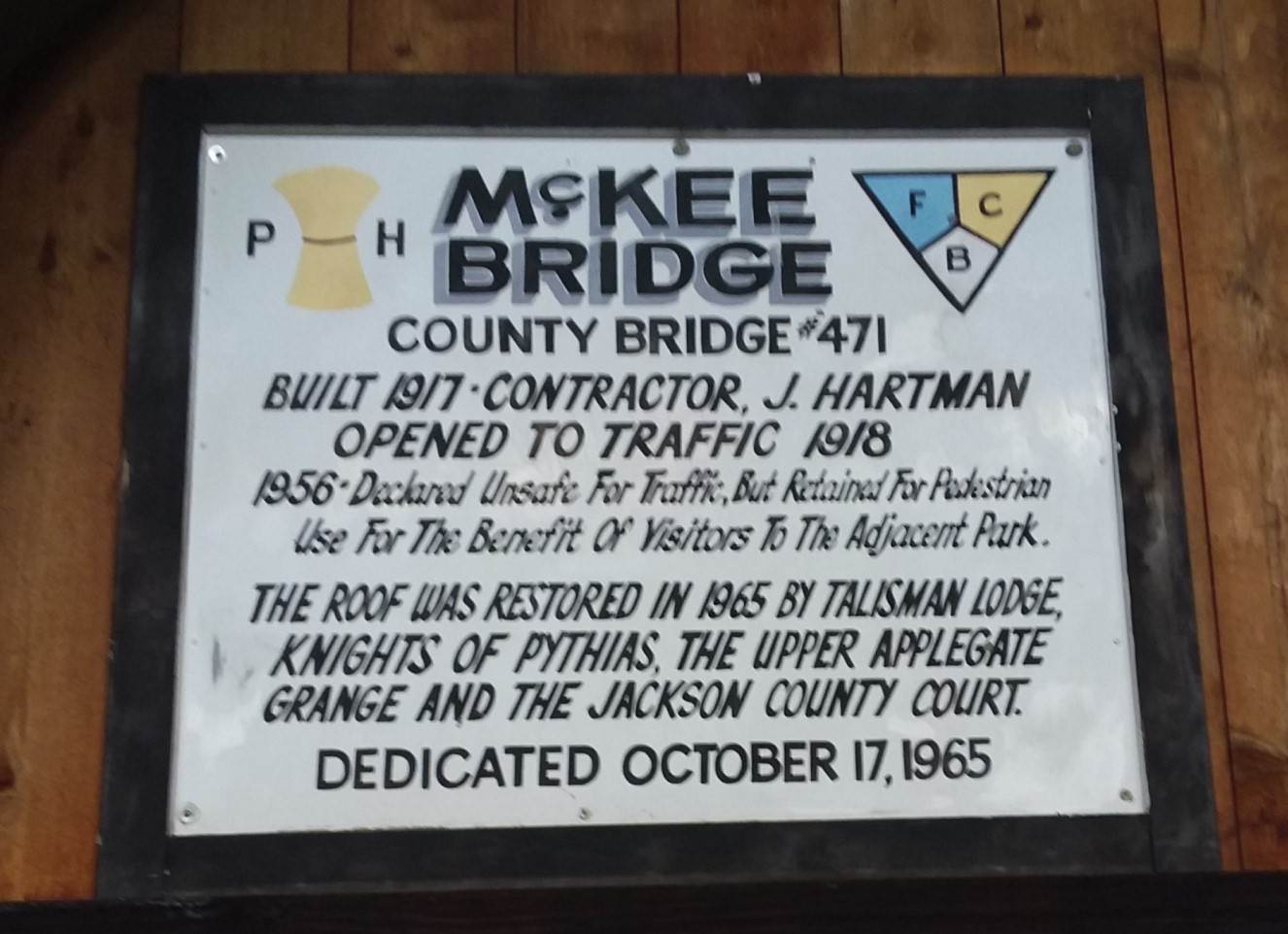
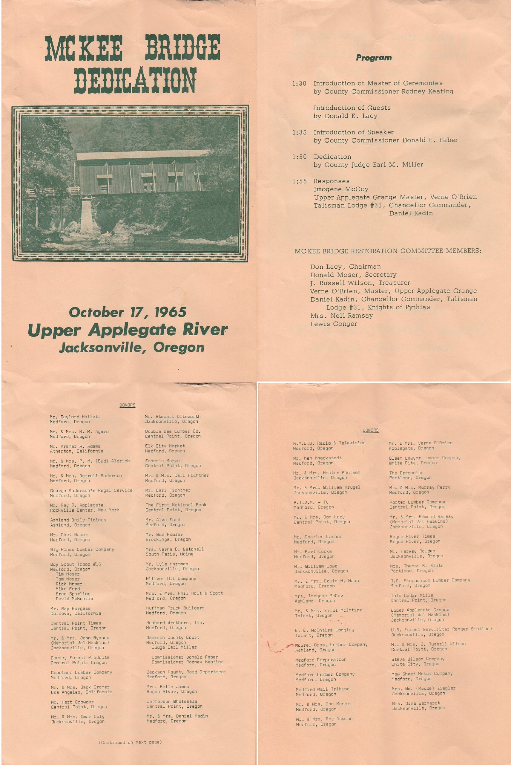
This plaque commemorating 1965 repairs was mounted over the northern entrance through the 1990s, and is now displayed inside the bridge.
Photo: Laura Ahearn.
| 1965 | The roof of McKee Bridge was restored. Major donors were the Knights of Pythias, Upper Applegate Grange, and Jackson County Court, but dozens of individuals and businesses contributed and were acknowledged at a rededication ceremony on October 17, 1965. |
| 1978 | Applegate Dam was built by the U.S. government, inundating “Big Applegate” and the village of Watkins. Bodies buried in the Collings cemetery were moved to the Logtown & Jacksonville cemeteries. |
| 1994-2006 | “Grandma Aggie” Pilgrim reenacted the Takelma salmon ceremony at Kanaka Gulch, downstream from Applegate Dam. (This is not the same place as Kanaka Flat!) In 2007 the ceremony moved to its traditional site, upstream of Gold Hill. |
| 1999 | McKee Bridge Historical Society (MBHS) was incorporated as an all-volunteer, non-profit entity to preserve McKee Bridge and the history of the Upper Applegate Valley. |